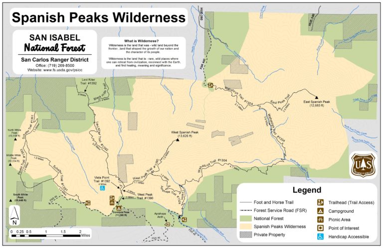
From La Veta take CO Highway 12 to County Road 360, drive six miles to the intersection with Forest Service Rd. 442. High clearance 4WD is needed Forest Service Road #442 to drive the last two miles to the Wahatoya Trailhead.
Maps and information can be found at the San Isabel National Forest La Veta Work Center:
103 E. Field St.,
La Veta, CO 81055
(719) 742-3681
Alternatively, contact the San Carlos Ranger District Office in Canon City at (719) 269-8500.
Dogs must be on a leash, or under voice control.